Amapá · Brasil
Amapá
Aviation heritage, natural landscapes and riverside life.
Photos
Select a photo to enlarge it. Captions identify the place and the source.
-
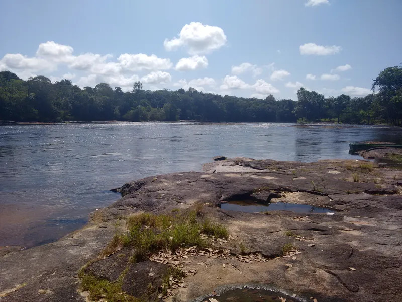
Riverside landscape in the municipality of Amapá. Photo: Pedro Paulo Alemanha · CC BY-SA 4.0 — Licence & original
Automatic translation. This text was translated from Portuguese by artificial intelligence and has not yet been reviewed by a person.
Explore
Explore Amapá
Tourist attractions in Amapá
-
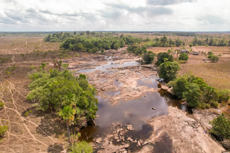 Nature
Amapá Amapá
Topéca Rapids
Rapids near Amapá town.
Image credits
Photo: Acervo Fecomércio Amapá / Cetur · Uso autorizado pela Fecomércio AP, titular do portal turismoamapa.com.br (21/10/2026). — Licence & original
-
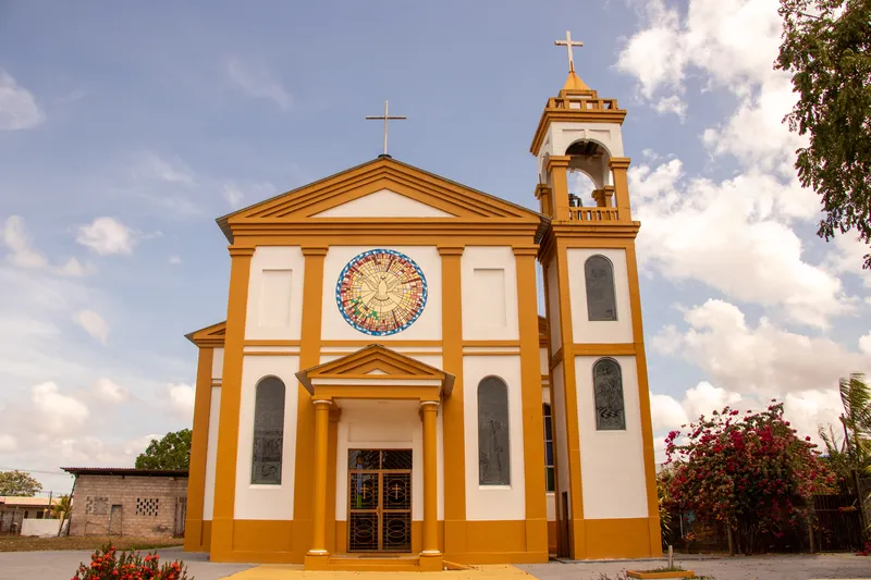 Church
Amapá Amapá
Nossa Senhora de Nazaré Church
Religious heritage in Amapá town.
Image credits
Photo: Acervo Fecomércio Amapá / Cetur · Uso autorizado pela Fecomércio AP, titular do portal turismoamapa.com.br (21/10/2026). — Licence & original
-
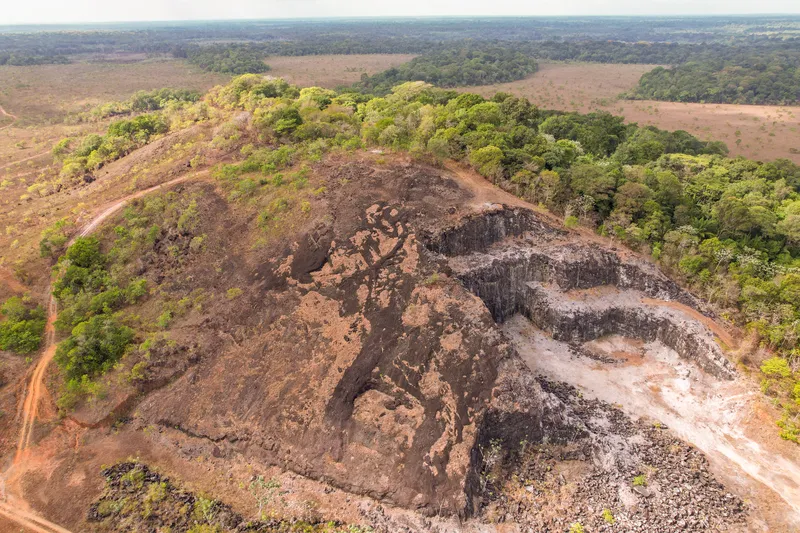 Nature
Amapá Amapá
Montanha da Pluma
A natural landmark in Amapá’s countryside.
Image credits
Photo: Acervo Fecomércio Amapá / Cetur · Uso autorizado pela Fecomércio AP, titular do portal turismoamapa.com.br (21/10/2026). — Licence & original
-
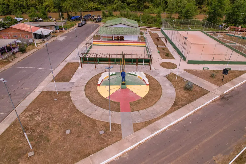 Square and waterfront
Amapá Amapá
Cabralzinho Square
A meeting point in Amapá town.
Image credits
Photo: Acervo Fecomércio Amapá / Cetur · Uso autorizado pela Fecomércio AP, titular do portal turismoamapa.com.br (21/10/2026). — Licence & original
-
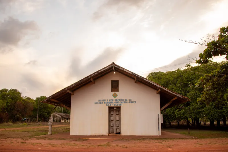 Heritage and history
Amapá Amapá
Amapá Naval Air Base ruins
Second World War aviation heritage.
Image credits
Photo: Acervo Fecomércio Amapá / Cetur · Uso autorizado pela Fecomércio AP, titular do portal turismoamapa.com.br (21/10/2026). — Licence & original
Use offline
Download the pages, photos, ready-made phrases and map of Amapá to open them without signal. Everything stays on this device only.
On iPhone, add AXITUR to your Home Screen: Safari may delete what a site downloaded if you have not opened it for 7 days.
Map
On the map
History
Listen to the story
Automatic reading of the text below in its available language. Offline use requires a voice installed on this device.
Read-aloud requires a compatible browser voice. The full text is available below.
The municipality of Amapá holds an important place in the history of the border between Brazil and French Guiana. The old town was at the centre of territorial disputes and the 1895 conflict, which remains part of local memory. The border settlement through arbitration in 1900 preceded the municipality’s creation in 1901, in a territory with much older settlement and social relationships.
In the twentieth century, the air base used during the Second World War added another layer to this history. Alongside these international connections, municipal life is tied to grasslands, waterways, fishing and livestock raising. Cheese production is an expression of this rural economy, offering a way to understand Amapá beyond its military landmarks.
Amapá’s memory as a former capital refers to the Federal Territory, the administrative entity that preceded today’s state. This distinction helps visitors recognise its political role beyond frontier disputes and the air base, without confusing it with Macapá, the present capital.
Sources & information
- Fecomércio AP — Amapá Accessed on 2026-09-22
- Prefeitura de Amapá — História do município Accessed on 2026-09-22
- Fecomércio/AP e Cetur/AP — Turismo no Amapá 2024, página PDF 32 Accessed on 2026-09-23
Official data
- IBGE code
- 1600105
- State
- AP
- Estimated population
- 8,447 (2026, IBGE)
- Brazilian Tourism Map
- Not verified