Amapá · Brasil
Santana
Islands, riverside leisure areas and port life reveal another side of the Amazon near Macapá.
Photos
Select a photo to enlarge it. Captions identify the place and the source.
-
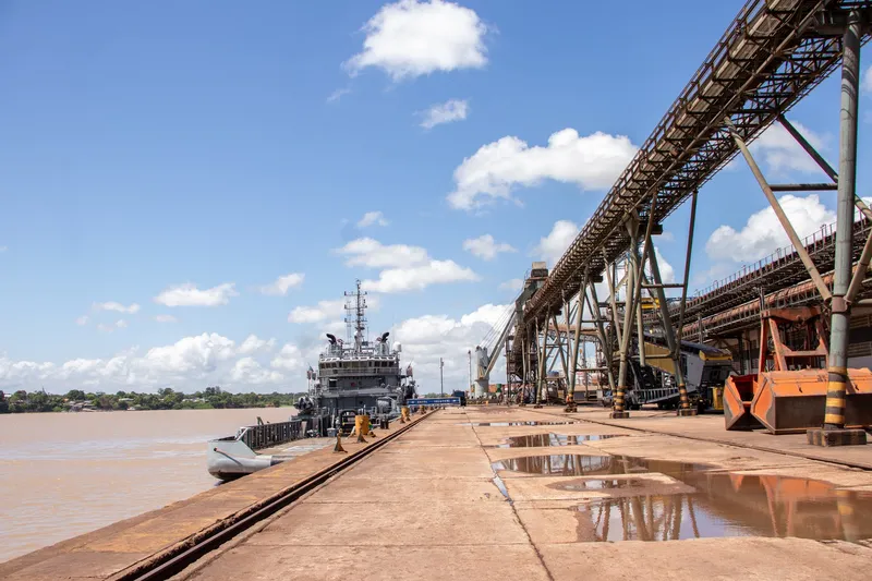
Port area of Santana, Amapá. Photo: jose donizetti dias · CC BY-SA 3.0 — Licence & original
Automatic translation. This text was translated from Portuguese by artificial intelligence and has not yet been reviewed by a person.
Explore
Explore Amapá
Tourist attractions in Santana
-
 Nature
Santana Amapá
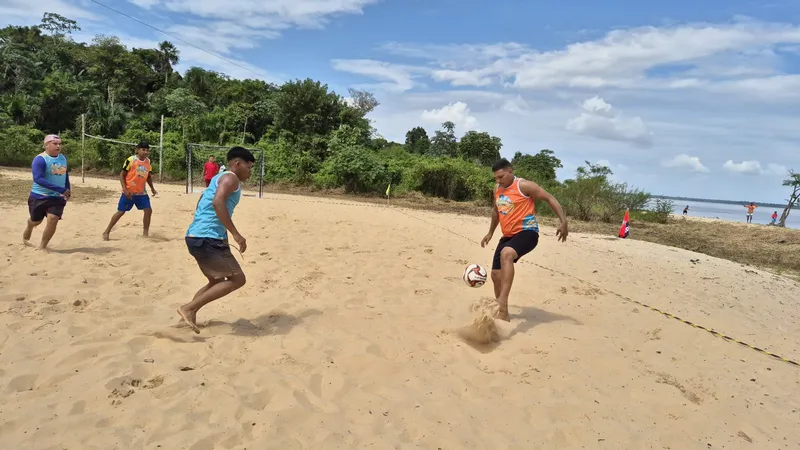
Balneário Recanto da Aldeia
Leisure site on Ilha de Santana hosting recreation and community events.
Image credits
Photo: Lucas Mota/ASCOM Prefeitura de Santana · Licença de reutilização da fotografia não informada pela fonte — Licence & original
-
 Culture and places
Santana Amapá
Docas de Santana
Port complex involved in cargo transport on the Amazon.
Image credits
Photo: Acervo Fecomércio Amapá / Cetur · Uso autorizado pela Fecomércio AP, titular do portal turismoamapa.com.br (21/10/2026). — Licence & original
-
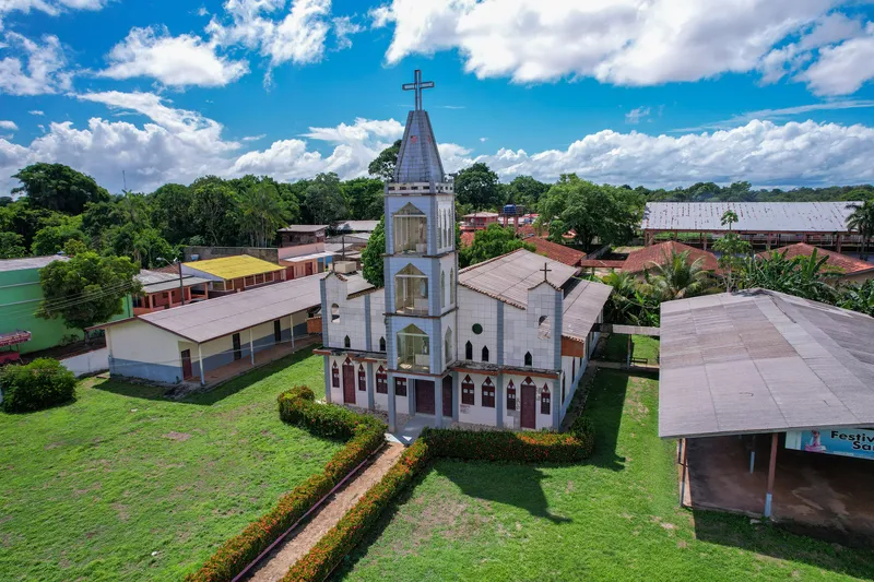 Church
Santana Amapá
Igreja da Ilha de Santana
Church included in Ilha de Santana’s tourism inventory.
Image credits
Photo: Acervo Fecomércio Amapá / Cetur · Uso autorizado pela Fecomércio AP, titular do portal turismoamapa.com.br (21/10/2026). — Licence & original
-
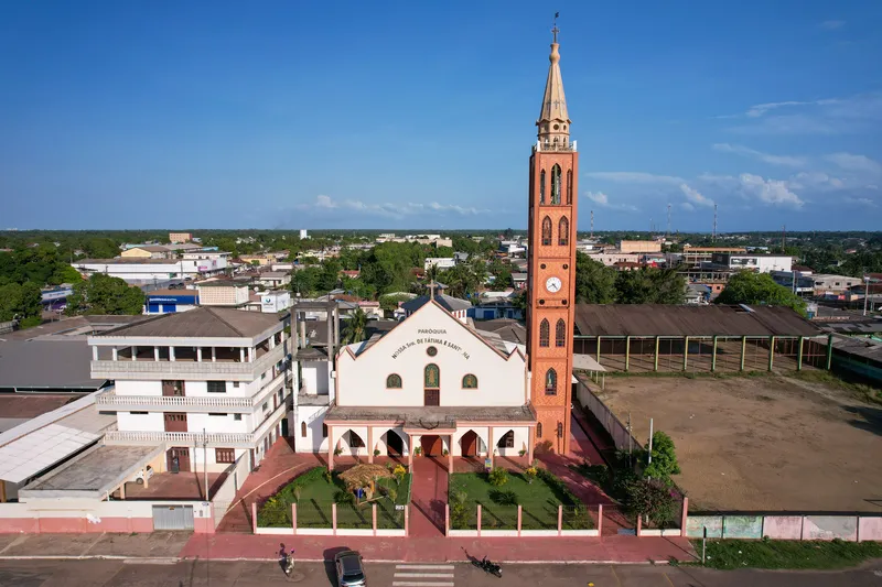 Church
Santana Amapá
Igreja Nossa Senhora de Fátima e Sant’Ana
Religious landmark included in Santana’s tourism inventory.
Image credits
Photo: Acervo Fecomércio Amapá / Cetur · Uso autorizado pela Fecomércio AP, titular do portal turismoamapa.com.br (21/10/2026). — Licence & original
-
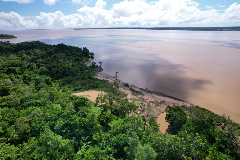 Trail
Santana Amapá
Ilha de Santana — Trilha das Samaúmas
Trail on Ilha de Santana, reached by boat via Recanto da Aldeia.
Image credits
Photo: Acervo Fecomércio Amapá / Cetur · Uso autorizado pela Fecomércio AP, titular do portal turismoamapa.com.br (21/10/2026). — Licence & original
-
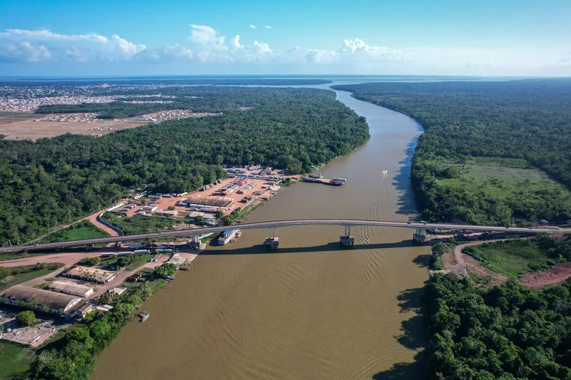 Bridge and landmark
Santana Amapá
Integration Bridge — Matapi River
A landmark in the road connection between Santana, Macapá and Mazagão.
Image credits
Photo: Acervo Fecomércio Amapá / Cetur · Uso autorizado pela Fecomércio AP, titular do portal turismoamapa.com.br (21/10/2026). — Licence & original
Use offline
Download the pages, photos, ready-made phrases and map of Santana to open them without signal. Everything stays on this device only.
On iPhone, add AXITUR to your Home Screen: Safari may delete what a site downloaded if you have not opened it for 7 days.
Map
On the map
No items with a location in this municipality yet.
Past events
History
Listen to the story
Automatic reading of the text below in its available language. Offline use requires a voice installed on this device.
Read-aloud requires a compatible browser voice. The full text is available below.
Santana’s development is tied to the Amazon River and the old settlement on Ilha de Santana, established during the colonial period. In the twentieth century, the Serra do Navio manganese industry transformed the region: the railway and port infrastructure connected inland mining with trade routes and attracted new residents. Santana became a municipality separate from Macapá in 1987.
This history helps explain a city of arrivals and departures, where port activity exists alongside island and riverside communities. Ilha de Santana preserves religious traditions and memories of early settlement, while boat traffic shows how important the waterways remain for work, travel and connections with other Amazonian communities.
On Ilha de Santana, colonial history brings together Tucuju Indigenous people, enslaved people and migrants from Pará. Historians invited by the municipality identify a settlement in 1753 and its formal recognition in 1758, administrative milestones in a territory with a much older human presence.
Sources & information
- Fecomércio AP — Visite Santana Accessed on 2026-09-17
- AMEAP — História e formação administrativa de Santana Accessed on 2026-09-22
- Prefeitura de Santana — Memória do povoado da Ilha de Santana Accessed on 2026-09-22
- Fecomércio/AP e Cetur/AP — Turismo no Amapá 2024, página PDF 61 Accessed on 2026-09-23
- Prefeitura de Santana — Historiadores discutem a formação do povoado da ilha, 2021 Accessed on 2026-09-23
Official data
- IBGE code
- 1600600
- State
- AP
- Estimated population
- 119,224 (2026, IBGE)
- Brazilian Tourism Map
- Yes (2025)